Subscribe to receive top agriculture news
Be informed daily with these free e-newsletters

Time-honored methods don't seem to be working as well anymore.
Anyone who pays attention to long-range weather forecasts is likely aware of at least two situations that seem to contradict themselves. First, months ago forecasters said a La Niña event was coming. Recently, they noted it had died out. Now the word is it might be back. Second, some private forecasts for winter are calling for very different outcomes than forecasts more closely tied to government weather services. What is going on with the weather, anyway?
Ken Scheeringa, associate Indiana state climatologist, says that’s a logical question. The problem, he says, is that even veteran forecasters don’t have all the answers.

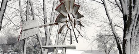
TO SNOW OR NOT TO SNOW? Some forecasters say to expect a snowy winter in Indiana; others say don’t buy a snowmobile just yet. The only thing experts can agree on is that the current weather picture is confusing.
Scheeringa attempts to explain what’s behind the confusing weather scenario in this exclusive interview with Indiana Prairie Farmer.
IPF: Is it true that La Niña may show up after all?
Scheeringa: Yes. Recall that the summer forecast for a strong La Niña in July following the end of the strong El Niño in May didn’t pan out. So ENSO [El Niño-Southern Oscillation] neutral conditions continued longer than expected into fall. But the latest forecast says La Niña will make a second attempt now, but in much weaker form. There have been some preliminary signs that the changeover has started already, such as the widespread drought in the Southeast U.S. It has led to recent wildfires. The drought there reflects an altered path of the jet stream over North America. The Climate Prediction Center gives La Niña a 55% chance of happening over this winter, but then ending when spring arrives.
IPF: Why is there so much disagreement among forecasters on what to expect this winter?
Scheeringa: There are some large-scale temperature patterns going on around the world that are new to us. That is why there are some obvious disagreements among forecasters about the winter outlook. The Arctic Ocean was extremely warm in November, with temperatures hovering near freezing, not much different than here in Indiana. Meanwhile, Pacific Ocean sea surface temperatures have been warm over a large portion of that body of water.
IPF: Isn’t warm sea surface waters usually a sign of an El Niño, not a La Niña?
Scheeringa: The warm sea surface temperatures have not been in the “Niño box” region long-term forecasters use to decide if a La Niña is occurring or not. So what do we call it — El Niño, neutral or La Niña, based on the traditional definitions? Even longtime climatologists are puzzled, wondering if we need to change our thinking about what we should be using for forecasting. Should we be using something else besides ENSO as our primary basis of making long-range outlooks?
Maybe forecasters need to move on to newer forecast tools, because the older ones don’t seem to be working as well anymore. Actually, the CPC is already working in that direction of finding better ways to make long-range outlooks.
IPF: Is this uncertainty feeding very diverse winter forecasts for the Midwest?
Scheeringa: Yes. This explains why you are hearing widely different versions of the winter forecast this time around, such as more snow due to a weak polar vortex pattern, which follows from the warm Arctic temperatures this month.
For now, ENSO is still the primary focus when CPC issues a seasonal outlook. And at the moment, there isn’t real proof that what the private forecasters are using is doing that much better.
You May Also Like
Enter a zip code to see the weather conditions for a different location.