Subscribe to receive top agriculture news
Be informed daily with these free e-newsletters

Moisture appears in the West, but is not enough to quench extensive drought effects
May 21, 2015
Storms across the U.S. last week had varied impacts in several regions, from lowland flooding in the southeastern Plains, light shows in the East, and cooler weather in the upper Midwest, said USDA's Brad Rippey in the latest Drought Monitor update.
Unsettled weather prevailed in the West, as heavy precipitation fell in the Intermountain region and central and southern Rockies. Beneficial showers also dampened parts of California and Nevada, but failed to dent the Far West's serious hydrological drought.

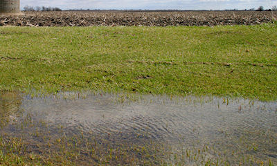
Many areas saw rain last week, some to the point of extensive flooding
About 52.2% of the contiguous U.S. is in some form of drought or dryness currently, compared to 55.8% last week and 48% one year ago. About 3.1% is in the most extreme rating, compared to 3.1% last week and 5% one year ago.
See last week's Drought Monitor update.
In the Northeast, a few bursts of thundershowers appeared, but the weather was mostly dry. Moderate drought was introduced in two areas—one stretching from parts of eastern Pennsylvania into New England, and the other covering much of northern New York.
Pockets of abnormal dryness dotted the Southeast, with moderate drought confined to southern Florida. Southern Florida continues to await the arrival of its summer wet season, with drought-related impacts expected to diminish once rains arrive. Elsewhere, patchy Southeastern dryness was promoting spring fieldwork but reducing streamflows and increasing stress on pastures and summer crops.
Significant rainfall pushed as far east as the upper Mississippi Valley but tapered to light showers east of the Mississippi River. As a result, substantial improvements in areas affected by dryness and drought were limited to the upper Midwest.
In the Great Plains, reductions in drought coverage were noted as late-season snow appeared in North Dakota and parts of Nebraska.
Spring precipitation in the Plains arrived mostly too late to revive winter wheat but has aided rangeland, pastures, and summer crops. By May 17, roughly one-third of the winter wheat was rated in very poor to poor condition in South Dakota (36%), Nebraska (31%), and Kansas (30%).
See the drought map comparison and continue reading >>
~~~PAGE_BREAK_HERE~~~
The damage to wheat was caused much earlier due to a combination of drought and winter weather extremes. Meanwhile, South Dakota's rangeland and pastures—which were rated 33% very poor to poor on May 3, improved to 24% very poor to poor by May 17.
Spring wheat, grown primarily in six Northern States from Washington to Minnesota, was off to a good start, with 65% of the crop rated good to excellent (and only 4% very poor to poor) on May 17.
Heavy showers and locally severe thunderstorms, however, led to flooding farther south, particularly across the southeastern Plains.
On the southern Plains, month-to-date rainfall has already exceeded a foot in many locations. In the Plains' cotton belt, incessant rains have hampered fieldwork. For example, only 19% of Texas' intended cotton acreage had been planted by May 17, compared to the 5-year average of 36%.
Cool, occasionally showery weather across much of the western U.S. reduced irrigation demands, boosted topsoil moisture, and benefited rangeland, pastures, winter grains, and spring-sown crops. However, the late-season moisture failed to significantly alter the bleak hydrological situation in drought-affected areas, including California.
Despite atypically heavy showers for May in California, Nevada, and Arizona, the drought depiction remained effectively unchanged.
Even with the showers, California's topsoil moisture was rated 85% very short to short on May 17, while subsoil moisture was 90% very short to short. Similarly, Nevada's topsoil moisture was 65% very short to short, while subsoil moisture was 85% very short to short.
More widespread precipitation has fallen in recent weeks across the central and southern Rockies and environs.
Due to the extensive precipitation, improved water-supply prospects, and boost in soil moisture, another round of sweeping improvements in the drought depiction were introduced in Colorado and New Mexico, extending northward into southern Wyoming and westward into eastern Utah.

Source: Brad Rippey, U.S. Department of Agriculture/ The U.S. Drought Monitor is produced in partnership between the National Drought Mitigation Center at the University of Nebraska-Lincoln, the United States Department of Agriculture, and the National Oceanic and Atmospheric Administration.
You May Also Like
Enter a zip code to see the weather conditions for a different location.


