

Subscribe to receive top agriculture news
Be informed daily with these free e-newsletters

Remote sensing shows promise in pasture management.
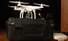
In the past couple years, UAVs, or unmanned aerial vehicles, have garnered a lot of attention, especially in the ag community. It's been said that agriculture holds the most potential for UAVs. Producers have heard about all the possibilities of UAVs in agriculture – from crop scouting to complex diagnostics using multispectral imagery. However, this new technology also holds promise for cattle producers.

PASTURE MANAGEMENT POTENTIAL: Using multispectral imagery with UAVs, researchers can take spectral reflectance measurements in visible and near infrared spectrums, and calculate NDVI using the ratio of the two spectrums. NDVI values, biomass of a particular species in a pasture can be estimated.
Remote sensing is nothing new to former Kansas State University agronomy professor Dr. Kevin Price. Now executive vice president of Applied Research and Technology Development at RoboFlight in Des Moines, Iowa, Price has made a career out of applying remote sensing technology to grassland management. This initially involved using satellites to classify rangeland cover types – identifying whether the ground was covered with grass, weeds, or was bare.
"As the technology matured, we used it for more than classification. We used it for biophysical measurements, which is biomass, leaf area, or productivity, those kinds of things," he says. "Now we're seeing not just what it is, but how much of it we have."
UAV advantage
Most recently, Price and his colleagues have been researching applications of multispectral imagery with UAVs for pasture management. Until recently, satellites have been the dominant method. Moving 17,000 miles per hour, at the Midwest's latitude, the Landsat satellite orbits over the same location every 16 days, and can take an image with a fifth of an acre per pixel resolution, or 30 square meters.
"If you're working in agriculture, you want the satellite to get around frequently, because the vegetation is changing frequently," Price says. "When using Landsat, if there are clouds when you're going over, you have to wait another 16 days to get an image."
Related: New Precision Aerial Ag Show Features UAV Showcase
On the other hand, a fixed-wing UAV flying 45 miles per hour can cover a square mile, or 640-acre pasture, in 20 minutes, providing a higher temporal resolution image with data values or pixels for every inch of pasture – and a UAV can be flown whenever the weather cooperates.
Using multispectral imagery, researchers can take spectral reflectance measurements in visible (often using red light) and near infrared spectrums, and calculate Normalized Difference Vegetation Index, or NDVI, using the ratio of the two spectrums. NDVI values are converted to numbers from 0 to 255, higher numbers indicating more green leaf material. Values are influenced by the concentration of chlorophyll in a unit area, and correlated with leaf area index and biomass. With NDVI values, biomass of a particular species can be estimated.
Dr. Walt Fick, K-State associate professor and range management researching these, notes using NDVI values, cattle producers can be proactive in pasture management by projecting how much production they can expect based on available biomass and how much rainfall is expected. "75% of our production occurs by the 15th of July, so a lot of rain after that doesn't add a lot of production." Fick says. "If you have a certain number of animals out there, we could predict how many days of grazing we have left even if we don't get any more rain."
Numerous possibilities
The usefulness of UAVs doesn't stop there. Price says there are numerous possibilities, including using NDVI values to distinguish grass from invasive weeds. UAVs could also be used to take simple aerial images to monitor cattle locations, grazing habits, and numbers. Multispectral imagery could even be used to locate hidden newborn calves.
Dwayne Rice, NRCS rangeland management specialist, who is researching applications of UAVs with multispectral imagery in the Smoky Hills of north central Kansas, says the real value will come when enough measurements from throughout the growing season are available to identify plant growth patterns that can be associated with critical growth stages and productivity of the plants.
Important growth stages might include the date of plant emergence or green-up, the rate of green-up, the date of maximum biomass accumulation, and rate of brown-down or maturity. Price refers to measurements of these stages as Vegetation Phenology Metrics (VPM). Each stage can be indicative of forage nutrient quality and quantity.
Rice notes, "If you know when plant green-up is initiated and can assess the rate of growth, the steepness of that plant growth curve between green-up and peak greenness, one will have a better understanding of forage productivity and quality in a given year."
Related: New Precision Aerial Ag Show Features UAV Showcase
However, before this technology becomes widely adopted, service providers have to be able to correlate the imagery back to actual pounds per acre to give producers recommendations. While more service providers are looking into this technology, understanding how to interpret collected data might require instruction from companies like RoboFlight, which works with service providers to help provide better information to farmers, Price says.
"I've talked to over 3,000 people in the last six or eight months [about UAVs and remote sensing], and they're learning, but this is still new," Price says. "We're at the very, very beginning of this technology. You might call it the bleeding cutting edge."
You May Also Like
Enter a zip code to see the weather conditions for a different location.


